Ozaukee County Landmarks
Click on symbol for details regarding landmark locations.
Guidinger farms are located on each end of the red line.
Guidinger farms are located on each end of the red line.
St. John's Cemetery-Mequon, WI
Location of Guidinger grave sites
Opitz Cemetery-Mequon, WI
Burial locations at the Opitz cemetery or AKA: Mequon cemetery
1830's Gov't Survey indicating the area where Thiensville was developed. Part of sec 22 and 23 along the Milwaukee River.
Mequon map of section 29.
Year of map is 1892.
click on map to enlarge it
Year of map is 1892.
click on map to enlarge it

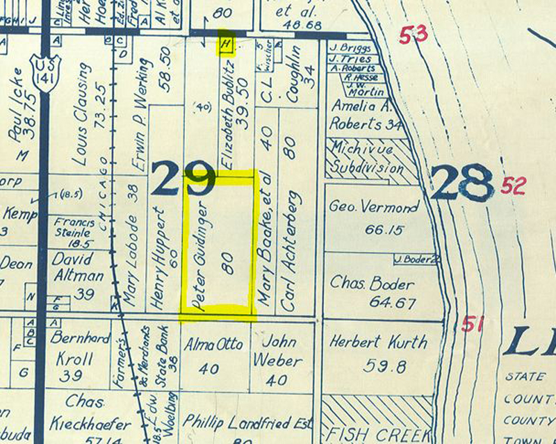
This is a parcel map from 1937 showing the original 80 acres that Peter Guidinger homesteaded in 1851 in what is now the City of Mequon. The smaller highlighted "H" is the house of Wilhelm Feldmann, Anna Guidinger's husband. The Feldmann location is where Peter Guidinger shot Henry Neires in 1885. The original 80 acre farm is now a subdivision called "The Pines".
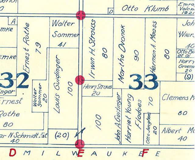
This a 1937 parcel map which shows the original 220 acres that Nicolas P Guidinger homesteaded in the 1850's. This land is located on County Line road at Swan road on Mequon's west side. Part of this land is now part of the Mequon Nature Preserve. The land was originally purchased by Nicolas P. Guidinger and was divided into three parts which passed on to his son John P Guidinger. John P Guidinger later divided those parts into two farms owned by his sons, John A Guidinger and Louis J Guidinger. Nicolas P Guidinger was the brother of Peter Guidinger, Peter purchased an 80 acre farm on the east side of Mequon.