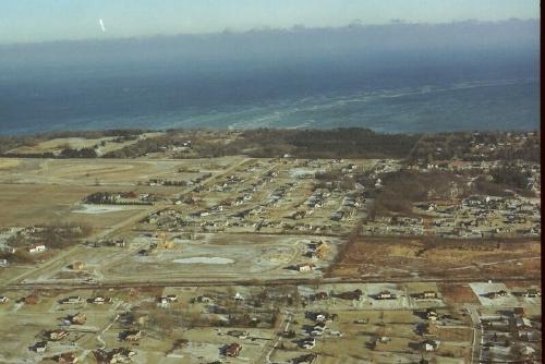
Achterberg farm is in the foreground and was under development for a subdivision. Lake Michigan in the background.

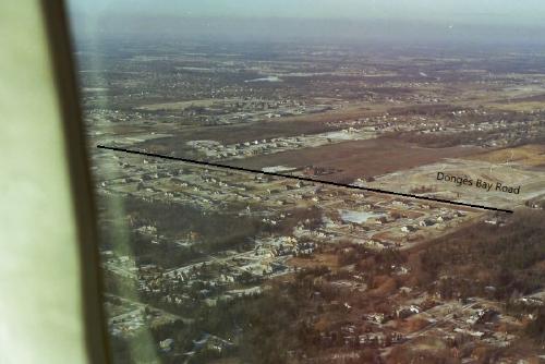
The black line indicates Donges Bay Road. Image view is NW as the plane flew over the Lake Michigan coast line. Guidinger farm is centered. Haddenstone is to the left of the Guidinger farm.

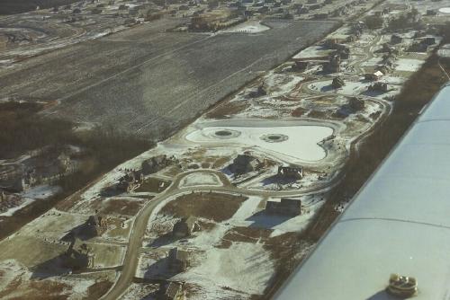
Aerial image is looking SE as the plane was over I-43. In the foreground is the Haddenstone subdivision. To the top of the image is the Guidinger farm. Part of the Zinke farm (woods) is seen on the left side of the image.

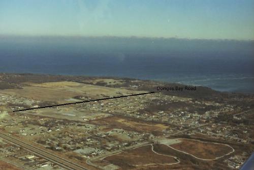
Black line indicates Donges Bay Road. Image is looking NE towards Lake Michigan. Foreground shows I-43, Katherine Kearny Park, Woelbing farm, Achterberg farm, Guidinger farm, Park Place (includes the Otto farm, Logemann farm and woods, Charles Achteberg farm, John Weber farm . Virmond county park is at top of image, along Lake Michigan shoreline. To the right of Virmond park is the Charles Boder woods (65 acres) where the Chalet on the Lake was located. The Herbert Kurth (60 acres) of woods is to the right of Boders property.